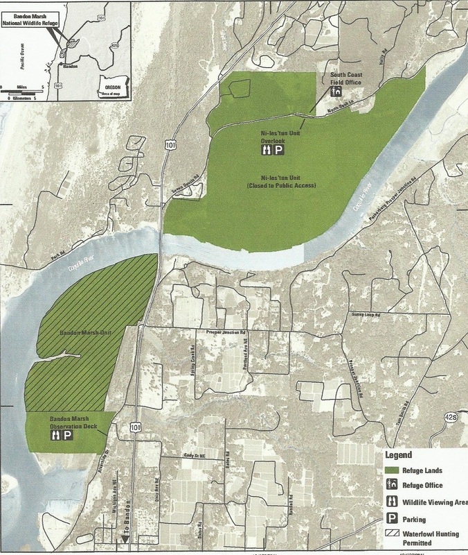
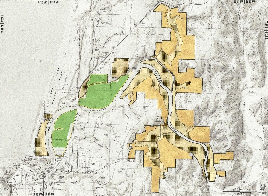
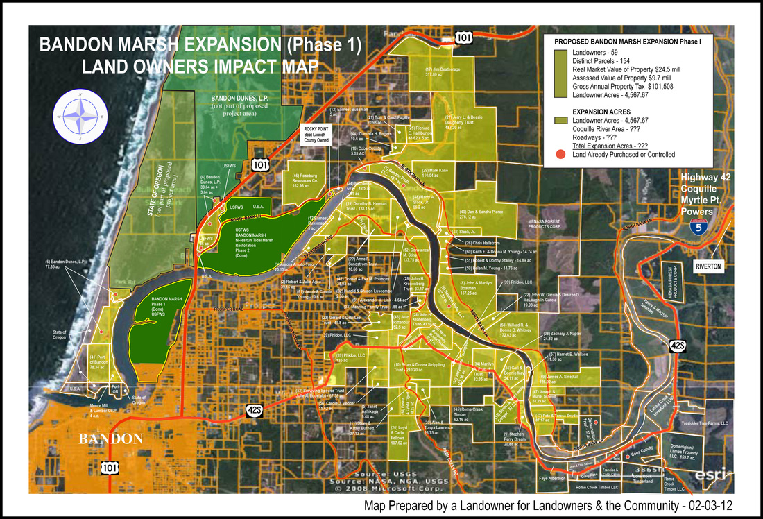
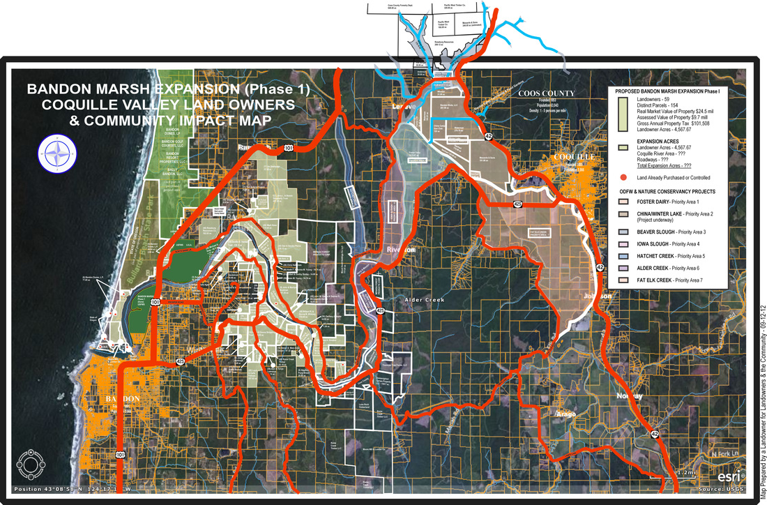
In the General Election of 2012, the citizens of Coos County passed a resolution opposing the planned 5,000-acre Bandon Marsh expansion by the USFWS. Many of us contended that The Service was going to use federal, state, and nongovernmental agencies, to do a 17,000-acre expansion.
We were wrong. The expansion is even larger.
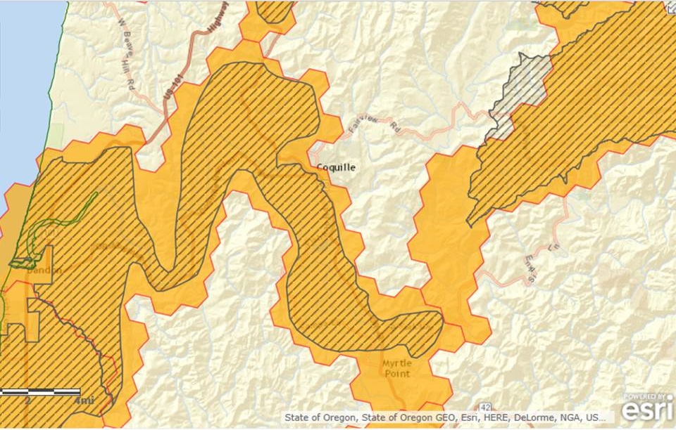
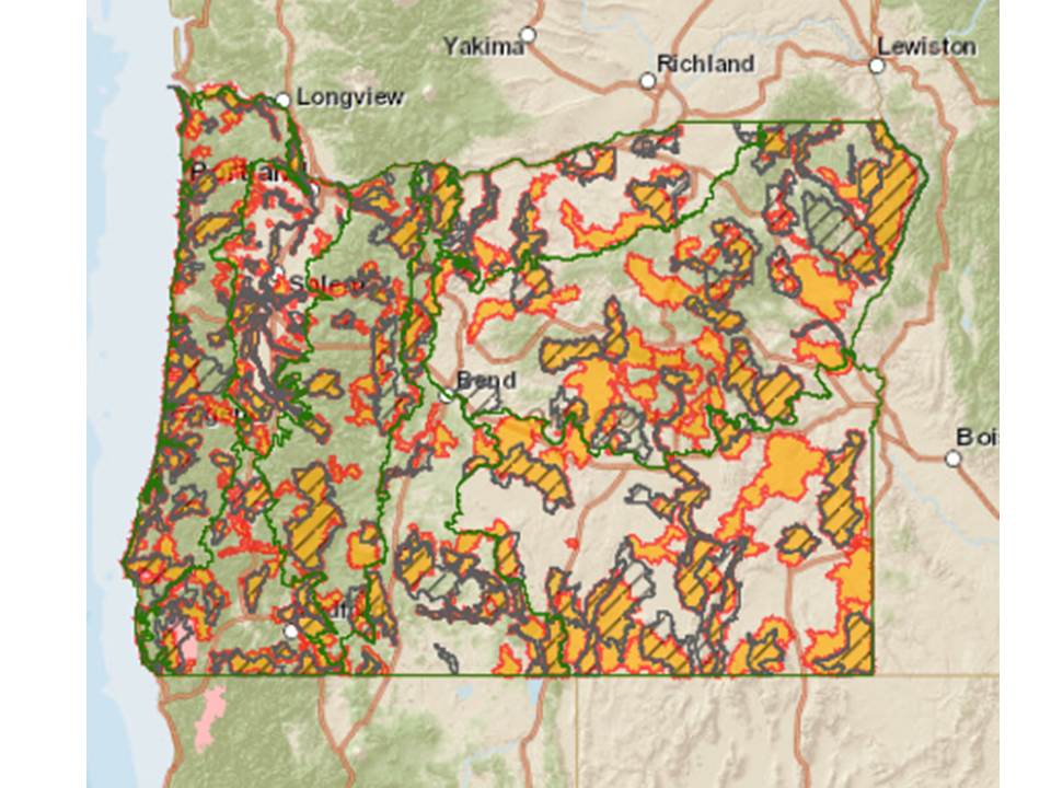
Here is a link to an interactive map of areas set for wetland restoration:
http://arcg.is/1OTTqTY
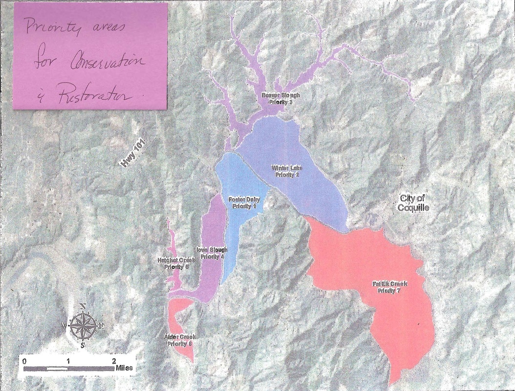
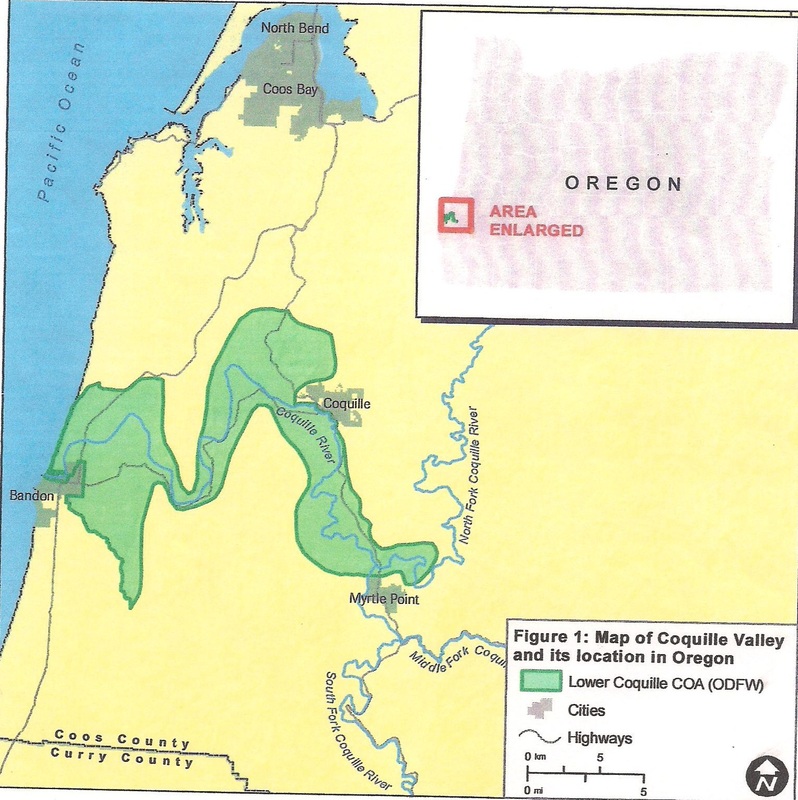
The following is the announcement from Oregon Department of Fish & Wildlife concerning possible Conservation Opportunity Areas in the state with maps showing the federal government’s progressive land grab in the Coquille Valley and beyond. It will eventually affect every person living in Coos County…..Rob T.
Hello again Conservation Strategists,
We wanted to let you know that the statewide Conservation Opportunity Area (COA) map is now available, including the remaining ecoregions. Arty Rodriguez, ODFW GIS analyst, has put together an updated online interactive map you can view here:
http://arcg.is/1OTTqTY
As before, please circulate this link to your colleagues as you see fit. The technical mapping process is completed, but if you have outstanding questions or comments on the results, please let us know as soon as possible. After next Tuesday August 11th we will have limited ability to make changes as the Strategy workplan turns towards writing the explanatory information for each COA (their “Profiles”), and the final online formatting of the Strategy so that we can complete the update by the October 1 deadline for the U.S. Fish and Wildlife Service.
As a brief reminder of the COA update process: We talked about the COA update process at our May 27 meeting. At that time, Arty (with close assistance from The Nature Conservancy and the US Fish and Wildlife Service) had just completed the first computer output using 2015 datasets to model COA boundaries, and we were beginning ODFW Fish and Wildlife District Biologist review. After many review sessions with district biologists throughout Oregon, Arty ran another iteration of the computer model, and the ODFW Conservation Program reviewed the output in detail to finalize the map now available above. The 2015 computer model results; 2005 COAs; and several additional landscape prioritization datasets (ex: TNC Willamette Synthesis and Statewide Portfolio, ODFW Sage-Grouse Core Areas, OWEB Focused Investment Partnership (FIP) areas and Salmon Strongholds provided by ODFW Conservation & Recovery, CHAT Connectivity Zones) were used in this final process to complete the 2015 COA map now available above. The statewide map will be presented at Friday’s Fish and Wildlife Commission meeting in Salem.
Some additional points about the COA update:
· COAs are areas where we want to focus conservation efforts and funding, with an emphasis on helping Oregon’s private landowners. COA delineations are focused on Conservation Strategy Species and Habitats, and no COA is being selected for an individual species.
· Clicking on COAs within the web map will bring up potential names for each COA. We are still working on names, and have posted a “working draft” list on Dropbox in case anyone has interest in taking a closer look.
· The 2005 COAs encompassed ~26% of the state of Oregon. The 2015 version now covers ~%35, which was our estimated maximum allowance for COA coverage.
· We decided to remove Wilderness Areas from the final COA designations. For the Strategy reader, we can provide links to more information about Wilderness Areas, including mapped information through ODFW’s Compass mapping application. Wilderness Areas helped the desktop analysis identify large blocks of land managed for native habitats, and in many cases COAs are near the boundary of Wilderness Areas. However, it was confusing to try to keep the Wilderness Areas as part of the final COA boundaries. Other public lands are considered depending on the situation. We will explain the role and recommended use of COAs for the Strategy reader through the web application
Thanks all and best wishes that you are getting some time to enjoy the summer.
Best, Audrey
Audrey Hatch
Oregon Conservation Strategy contractor
(541) 207-1038
USACE ~ Comment on Permit Application Process Wednesday November 18, 2015
USFWS ~ Treating Private Property off the Bandon Marsh
The Mosquitoes Return to the Coquille Valley
Sweet Recall Meeting 7:00pm Friday July 31, 2015
Two Bills on Wetlands in Oregon Legislature SB544 Protects Landowners
ACTION ALERT ~ Bandon City Council Meeting Jan. 5, 2015 ~ Real Mosquito Report
Fred Messerle Bankrupting Beaver Slough Drainage District to Harass Neighbor
ODFW ~ Permit for the Winter Lake/China Creek Project, Messerle Named Manager
ODFW ~ Purchases Private Property for Wetland Restoration "Mosquito Preserve"
Did the Mayor of Bandon Lie to the People of Coos County?
Officials Obscuring Facts on the Bandon Marsh Mosquito Infestation
#USFWS Admits Fault for the Bandon Mosquito Infestation
Someone should have told the USFWS the Three Reasons Mosquitoes Suck
USFWS---Coos County Public Health Joint Press Release Bandon Marsh Mosquitoes
Promoting the Bandon Marsh at the Oregon Film Festival
Federal Register taking comments on hunting in The Bandon Marsh
The Nature Conservancy---Oregon Grasslands: Crucial for Wildlife Survival
US Department of Interior Propaganda Press Release on Imaginary Economic Engine
USFWS---Post Card & News Release on Bandon Marsh Mosquito EA March 11, 2014
USDA---National Resources Inventory Summary Report 2010, not good for OR-Farms
Congressman Peter DeFazio Votes in favor of more Land Acquisitions
This Land is... the Government's
The Bandon Marsh---Xerces Opposes Bandon Marsh Spraying
The Nature Conservancy---Contact the Oregon Leadership Team
American Policy Center---news on more Federal Land grabs
The National Fish & Wildlife Foundation
EPA---Victims of Government: The Case of Steve Lathrop, Sounds Familiar

 RSS Feed
